
Make a donation
Gear up for your next adventure:
As an Amazon Associate, this site earns from qualifying purchases at no extra cost to you.
Kundala Dam topographic map
Click on the map to display elevation.
Make a donation
Gear up for your next adventure:
As an Amazon Associate, this site earns from qualifying purchases at no extra cost to you.
About this map
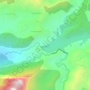
Name: Kundala Dam topographic map, elevation, terrain.
Location: Kundala Dam, Devikulam, Idukki, Kerala, India (10.14334 77.19788 10.14410 77.19921)
Average elevation: 1,814 m
Minimum elevation: 1,605 m
Maximum elevation: 2,210 m
Make a donation
Gear up for your next adventure:
As an Amazon Associate, this site earns from qualifying purchases at no extra cost to you.
Other topographic maps
Click on a map to view its topography, its elevation and its terrain.
Anamudi Shola National Park
India > Kerala > Devikulam > Marayoor > Champakkad
Average elevation: 1,858 m
Make a donation
Gear up for your next adventure:
As an Amazon Associate, this site earns from qualifying purchases at no extra cost to you.
Make a donation
Gear up for your next adventure:
As an Amazon Associate, this site earns from qualifying purchases at no extra cost to you.