
Peru topographic map
Click on the map to display elevation.
About this map
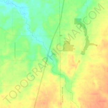
Name: Peru topographic map, elevation, terrain.
Location: Peru, Peru Township, Huron County, Ohio, United States (41.15005 -82.66240 41.19005 -82.62240)
Average elevation: 247 m
Minimum elevation: 221 m
Maximum elevation: 268 m
Other topographic maps
Click on a map to view its topography, its elevation and its terrain.