
Perušić topographic map
Click on the map to display elevation.
Perušić
The Municipality of Perušić is located in the southeastern part of Lika, at an altitude of 575–600 metres (1,886–1,969 ft), in a valley of the Lika River watershed. It lies in a field, Perušićko polje, bounded by the hills west of Klis and the railway line east of the Old Town of Perušić (Stari grad Perušić a.k.a. Gradina).
About this map
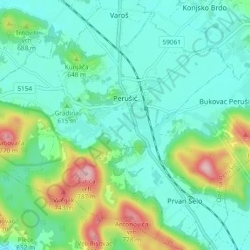
Name: Perušić topographic map, elevation, terrain.
Location: Perušić, Općina Perušić, Lika-Senj County, Croatia (44.62332 15.34384 44.66642 15.41053)
Average elevation: 608 m
Minimum elevation: 555 m
Maximum elevation: 771 m
Other topographic maps
Click on a map to view its topography, its elevation and its terrain.