Geolocate

Vries topographic map

Click on the map to display elevation.

About this map

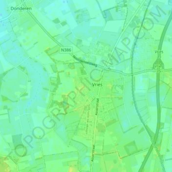
Name: Vries topographic map, elevation, terrain.

Location: Vries, Tynaarlo, Drenthe, Netherlands (53.05458 6.54804 53.09813 6.60119)

Average elevation: 8 m

Minimum elevation: 2 m

Maximum elevation: 16 m

Gear up for your next adventure:

👟Heavy Duty Boot Laces - Always carry a spare for your hiking footwear
🗺️Ordnance Survey Maps - Official UK maps for walking and outdoor activities
🧤Thermal Touchscreen Gloves - Stay warm while operating your GPS or smartphone camera
📸Action Camera Chest Mounts - Record your ascent following topographic paths hands-free
🧥Breathable Waterproof Jackets - Essential rain protection for the unpredictable British climate

As an Amazon Associate, this site earns from qualifying purchases at no extra cost to you.