
Thank you for supporting this site ❤️
Make a donation
Make a donation
Gear up for your next adventure:
As an Amazon Associate, this site earns from qualifying purchases at no extra cost to you.
Karatepe topographic map
Click on the map to display elevation.
Thank you for supporting this site ❤️
Make a donation
Make a donation
Gear up for your next adventure:
As an Amazon Associate, this site earns from qualifying purchases at no extra cost to you.
About this map
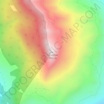
Name: Karatepe topographic map, elevation, terrain.
Location: Karatepe, Gazipaşa, Antalya, Mediterranean Region, Turkey (36.42458 32.39177 36.42468 32.39187)
Average elevation: 1,125 m
Minimum elevation: 693 m
Maximum elevation: 1,567 m
Thank you for supporting this site ❤️
Make a donation
Make a donation
Gear up for your next adventure:
As an Amazon Associate, this site earns from qualifying purchases at no extra cost to you.