Geolocate

Dimondale topographic map

Click on the map to display elevation.

About this map
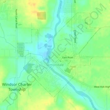
Name: Dimondale topographic map, elevation, terrain.

Location: Dimondale, Eaton County, Michigan, United States (42.63756 -84.65958 42.65834 -84.63373)

Average elevation: 266 m

Minimum elevation: 254 m

Maximum elevation: 282 m

Other topographic maps

Click on a map to view its topography, its elevation and its terrain.
Lake Interstate

United States > Michigan > Eaton County

Average elevation: 267 m

Gear up for your next adventure:

👖Hiking Trousers - Durable trousers designed for rough terrain
👟Heavy Duty Boot Laces - Always carry a spare for your hiking footwear
🪓Outdoor Multitools - Versatile tools for hiking and camping
🧢Thermal Beanie Hats - Prevent heat loss from the head in windy summit conditions
🥾Hiking Boot Waterproofing Wax - Maintain the lifespan of your leather trekking boots

As an Amazon Associate, this site earns from qualifying purchases at no extra cost to you.