
La Dehesa topographic map
Interactive map
Click on the map to display elevation.
About this map
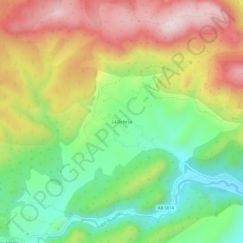
Name: La Dehesa topographic map, elevation, terrain.
Location: La Dehesa, Nerpio, Castilië-La Mancha, Spanje (38.13757 -2.38101 38.17757 -2.34101)
Average elevation: 1,328 m
Minimum elevation: 1,114 m
Maximum elevation: 1,584 m