
Thank you for supporting this site ❤️
Make a donation
Make a donation
Gear up for your next adventure:
As an Amazon Associate, this site earns from qualifying purchases at no extra cost to you.
Antuyo topographic map
Click on the map to display elevation.
Thank you for supporting this site ❤️
Make a donation
Make a donation
Gear up for your next adventure:
As an Amazon Associate, this site earns from qualifying purchases at no extra cost to you.
About this map
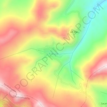
Name: Antuyo topographic map, elevation, terrain.
Location: Antuyo, Tambobamba, Cotabambas, Apurímac, Perú (-14.08258 -72.28177 -14.04258 -72.24177)
Average elevation: 4,125 m
Minimum elevation: 3,800 m
Maximum elevation: 4,411 m
Thank you for supporting this site ❤️
Make a donation
Make a donation
Gear up for your next adventure:
As an Amazon Associate, this site earns from qualifying purchases at no extra cost to you.