
Thank you for supporting this site ❤️
Make a donation
Make a donation
Gear up for your next adventure:
As an Amazon Associate, this site earns from qualifying purchases at no extra cost to you.
Tambilla topographic map
Click on the map to display elevation.
Thank you for supporting this site ❤️
Make a donation
Make a donation
Gear up for your next adventure:
As an Amazon Associate, this site earns from qualifying purchases at no extra cost to you.
About this map
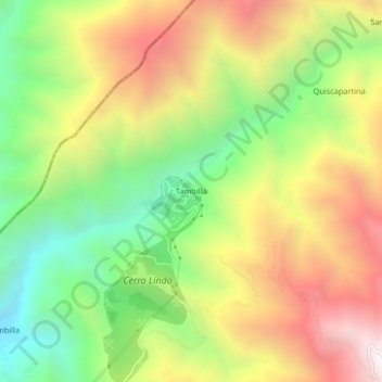
Name: Tambilla topographic map, elevation, terrain.
Location: Tambilla, Chavín, Province of Chincha, Ica, Peru (-13.09741 -76.00911 -13.05741 -75.96911)
Average elevation: 2,213 m
Minimum elevation: 1,580 m
Maximum elevation: 2,934 m
Thank you for supporting this site ❤️
Make a donation
Make a donation
Gear up for your next adventure:
As an Amazon Associate, this site earns from qualifying purchases at no extra cost to you.