
Bromley topographic map
Interactive map
Click on the map to display elevation.
About this map
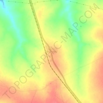
Name: Bromley topographic map, elevation, terrain.
Location: Bromley, Goromonzi, Mashonaland East Province, Zimbabwe (-18.08784 31.32107 -18.04784 31.36107)
Average elevation: 1,555 m
Minimum elevation: 1,518 m
Maximum elevation: 1,581 m