
Village of Babylon topographic map
Interactive map
Click on the map to display elevation.
About this map
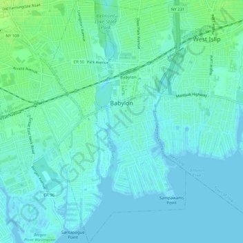
Name: Village of Babylon topographic map, elevation, terrain.
Average elevation: 4 m
Minimum elevation: -2 m
Maximum elevation: 12 m
Other topographic maps
Click on a map to view its topography, its elevation and its terrain.
Village of Amityville
United States > New York > Suffolk County > Town of Babylon
Average elevation: 6 m
Village of Lindenhurst
United States > New York > Suffolk County > Town of Babylon
Average elevation: 7 m
Robert Moses State Park (Long Island)
United States > New York > Suffolk County > Town of Babylon
Average elevation: 0 m
Wheatley Heights
United States > New York > Suffolk County > Town of Babylon > Wheatley Heights
Average elevation: 35 m