
Kamuge topographic map
Interactive map
Click on the map to display elevation.
About this map
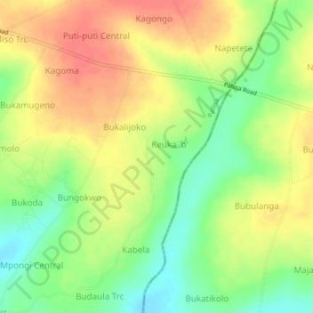
Name: Kamuge topographic map, elevation, terrain.
Location: Kamuge, Pallisa, Eastern Region, Uganda (1.12000 33.79417 1.16000 33.83417)
Average elevation: 1,093 m
Minimum elevation: 1,063 m
Maximum elevation: 1,120 m