Geolocate

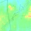
Buckner topographic map

Click on the map to display elevation.

About this map

Name: Buckner topographic map, elevation, terrain.

Location: Buckner, Franklin County, Illinois, 62819, United States (37.97374 -89.02726 37.98702 -89.00232)

Average elevation: 122 m

Minimum elevation: 111 m

Maximum elevation: 144 m

Other topographic maps

Click on a map to view its topography, its elevation and its terrain.
Akin

United States > Illinois > Franklin County

Average elevation: 143 m

Gear up for your next adventure:

🧊Insulated Flasks - Keeps drinks hot or cold during hikes
👖Hiking Trousers - Durable trousers designed for rough terrain
📦Dry Bags - Waterproof bags to protect gear from rain
📸Action Camera Chest Mounts - Record your ascent following topographic paths hands-free
🛰️Outdoor GPS Navigation - Navigation devices for remote and off-grid areas

As an Amazon Associate, this site earns from qualifying purchases at no extra cost to you.