Geolocate

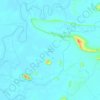
Sekubang topographic map

Click on the map to display elevation.

About this map

Name: Sekubang topographic map, elevation, terrain.

Location: Sekubang, Sintang, West Kalimantan, Indonesia (-0.28030 111.10758 -0.24030 111.14758)

Average elevation: 53 m

Minimum elevation: 38 m

Maximum elevation: 177 m

Other topographic maps

Click on a map to view its topography, its elevation and its terrain.
Sepauk

Indonesia > West Kalimantan > Sintang

Average elevation: 122 m

Kelam Permai

Indonesia > West Kalimantan > Sintang

Average elevation: 46 m

Gear up for your next adventure:

🥾Women's Waterproof Hiking Boots - High-performance trekking boots designed for all-weather comfort
🧥Softshell Jackets - Breathable jackets for active outdoor use
🥤Hiking Water Bottles - Reusable bottles for hydration on the trail
🧥Waterproof Hiking Jackets - Rain protection for walking in all weather conditions
🚶Walking Pedometers - Simple distance tracking for casual trail walkers

As an Amazon Associate, this site earns from qualifying purchases at no extra cost to you.