Geolocate

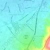
Azganlık topographic map

Click on the map to display elevation.

About this map

Name: Azganlık topographic map, elevation, terrain.

Location: Azganlık, İskenderun, Hatay, Mediterranean Region, 31280, Turkey (36.67729 36.20651 36.71729 36.24651)

Average elevation: 248 m

Minimum elevation: 0 m

Maximum elevation: 908 m

Other topographic maps

Click on a map to view its topography, its elevation and its terrain.
Mustafa Kemal Mahallesi

Turkey > İskenderun

Average elevation: 30 m

Gear up for your next adventure:

🧘Folding Sit Mats - Dry and warm seat for map-reading breaks on damp ground
🔥Emergency Fire Starters - Reliable ignition tools for survival situations in damp conditions
🔦Outdoor Torches - Reliable torches for night navigation
🧭GPS Trackers - Tracking devices for safety and navigation
💧Hydration Reservoirs - Convenient water bladders for hands-free drinking on the move

As an Amazon Associate, this site earns from qualifying purchases at no extra cost to you.