
Aeugst am Albis topographic map
Interactive map
Click on the map to display elevation.
About this map
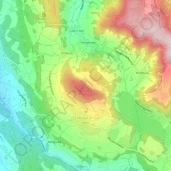
Name: Aeugst am Albis topographic map, elevation, terrain.
Location: Aeugst am Albis, Bezirk Affoltern, Zurich, Switzerland (47.25722 8.47113 47.29303 8.51134)
Average elevation: 668 m
Minimum elevation: 512 m
Maximum elevation: 890 m
Other topographic maps
Click on a map to view its topography, its elevation and its terrain.