
Thank you for supporting this site ❤️
Make a donation
Make a donation
Gear up for your next adventure:
As an Amazon Associate, this site earns from qualifying purchases at no extra cost to you.
Giradot topographic map
Click on the map to display elevation.
Thank you for supporting this site ❤️
Make a donation
Make a donation
Gear up for your next adventure:
As an Amazon Associate, this site earns from qualifying purchases at no extra cost to you.
About this map
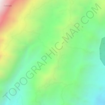
Name: Giradot topographic map, elevation, terrain.
Location: Giradot, Chima, Comunera, Santander, Colombia (6.36526 -73.39508 6.38526 -73.37508)
Average elevation: 1,500 m
Minimum elevation: 1,150 m
Maximum elevation: 2,078 m
Thank you for supporting this site ❤️
Make a donation
Make a donation
Gear up for your next adventure:
As an Amazon Associate, this site earns from qualifying purchases at no extra cost to you.