
Würenlos topographic map
Interactive map
Click on the map to display elevation.
About this map
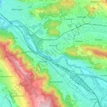
Name: Würenlos topographic map, elevation, terrain.
Location: Würenlos, Bezirk Baden, Aargau, Switzerland (47.40751 8.33667 47.46623 8.44037)
Average elevation: 472 m
Minimum elevation: 359 m
Maximum elevation: 732 m
Other topographic maps
Click on a map to view its topography, its elevation and its terrain.