
Schwarzenbach topographic map
Interactive map
Click on the map to display elevation.
About this map
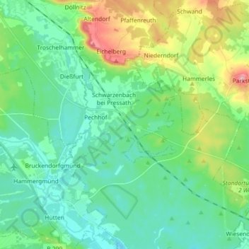
Name: Schwarzenbach topographic map, elevation, terrain.
Average elevation: 436 m
Minimum elevation: 390 m
Maximum elevation: 572 m
Other topographic maps
Click on a map to view its topography, its elevation and its terrain.
Hofstatt
Deutschland > Bayern > Landkreis Neustadt an der Waldnaab > Floß
Hofstatt, Floß, Landkreis Neustadt an der Waldnaab, Bayern, 92685, Deutschland
Average elevation: 526 m