
Great Sitkin Island topographic map
Interactive map
Click on the map to display elevation.
About this map
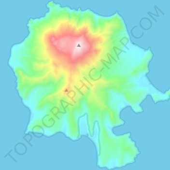
Name: Great Sitkin Island topographic map, elevation, terrain.
Average elevation: 211 m
Minimum elevation: -2 m
Maximum elevation: 1,726 m
Other topographic maps
Click on a map to view its topography, its elevation and its terrain.
Carlisle Island
United States > Alaska > Aleutians West Census Area
Despite its modest summit elevation, a small glacier exists high on the western slopes just below the rim of the summit crater.
Average elevation: 217 m
Chagulak Island
United States > Alaska > Aleutians West Census Area
Chagulak Island (also spelled Chugul, Chugula, Chegoula, or Tchougoulok; Russian: Чагулак) is a small, uninhabited volcanic island in the Islands of Four Mountains group in the Aleutian Islands of southwestern Alaska, United States. The 1.9 mi (3.1 km)-wide island consists of a single cone that reaches…
Average elevation: 160 m