
Choszczno topographic map
Interactive map
Click on the map to display elevation.
About this map
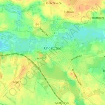
Name: Choszczno topographic map, elevation, terrain.
Average elevation: 57 m
Minimum elevation: 42 m
Maximum elevation: 70 m
Other topographic maps
Click on a map to view its topography, its elevation and its terrain.
gmina Drawno
Poland > West Pomeranian Voivodeship > Choszczno County
gmina Drawno, Choszczno County, West Pomeranian Voivodeship, 73-220, Poland
Average elevation: 95 m