
Umejero topographic map
Interactive map
Click on the map to display elevation.
About this map
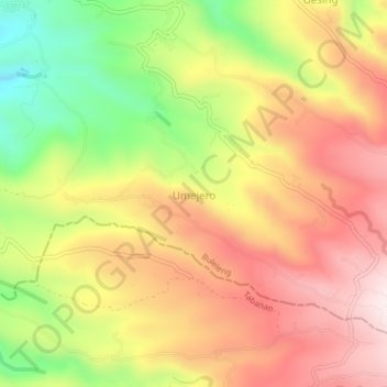
Name: Umejero topographic map, elevation, terrain.
Location: Umejero, Buleleng, Bali, Lesser Sunda Islands, Indonesia (-8.31857 115.02155 -8.27857 115.06155)
Average elevation: 763 m
Minimum elevation: 436 m
Maximum elevation: 1,027 m
Other topographic maps
Click on a map to view its topography, its elevation and its terrain.