
Coepelduynen topographic map
Interactive map
Click on the map to display elevation.
About this map
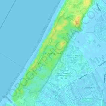
Name: Coepelduynen topographic map, elevation, terrain.
Location: Coepelduynen, Noordwijk, Katwijk, South Holland, Netherlands (52.21341 4.40494 52.23389 4.42962)
Average elevation: 4 m
Minimum elevation: -3 m
Maximum elevation: 26 m
Other topographic maps
Click on a map to view its topography, its elevation and its terrain.
Katwijk
Netherlands > South Holland > Katwijk
Katwijk, South Holland, Netherlands
Average elevation: 3 m