
Etzel topographic map
Interactive map
Click on the map to display elevation.
About this map
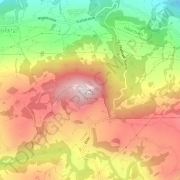
Name: Etzel topographic map, elevation, terrain.
Location: Etzel, Feusisberg, Höfe, Schwyz, 8835, Schweiz (47.17762 8.76789 47.17772 8.76799)
Average elevation: 839 m
Minimum elevation: 535 m
Maximum elevation: 1,095 m
Der Etzel (1097 m ü. M.) ist ein Berg zwischen dem Zürichsee und dem Sihlsee im Kanton Schwyz in der Schweiz. Der Etzel wird als Hausberg von Pfäffikon bezeichnet. Die obersten 100 Höhenmeter des freistehenden Gipfels sind rundum bewaldet. Auf der dem Zürichsee zugewandten Nordflanke reicht der Wald bis auf 800 m hinunter.