Geolocate

Milland topographic map

Click on the map to display elevation.

About this map

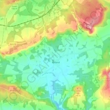
Name: Milland topographic map, elevation, terrain.

Location: Milland, Chichester, West Sussex, England, United Kingdom (51.01081 -0.84369 51.06921 -0.77098)

Average elevation: 100 m

Minimum elevation: 42 m

Maximum elevation: 202 m

West Sussex trails, hiking, mountain biking, running and outdoor activities

Gear up for your next adventure:

🧢Waterproof Hiking Hats - Keep the rain off your face while studying topographic maps
🔦Outdoor Torches - Reliable torches for night navigation
🔋Power Banks - Portable chargers for long outdoor trips
🔦Waterproof LED Headlamps - Hands-free lighting for evening treks and emergency navigation
🛰️Outdoor GPS Navigation - Navigation devices for remote and off-grid areas

As an Amazon Associate, this site earns from qualifying purchases at no extra cost to you.