
Ar Rahidah topographic map
Interactive map
Click on the map to display elevation.
About this map
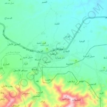
Name: Ar Rahidah topographic map, elevation, terrain.
Location: Ar Rahidah, Dimnat Khadir District, Ta'izz Governorate, Yemen (13.33793 44.26167 13.41793 44.34167)
Average elevation: 1,099 m
Minimum elevation: 922 m
Maximum elevation: 1,668 m