Geolocate

Oton topographic map

Click on the map to display elevation.

About this map

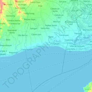
Name: Oton topographic map, elevation, terrain.

Location: Oton, Iloilo, Western Visayas, 5020, Philippines (10.60649 122.41991 10.77121 122.52416)

Average elevation: 11 m

Minimum elevation: -2 m

Maximum elevation: 109 m

Other topographic maps

Click on a map to view its topography, its elevation and its terrain.

Cagbang

Philippines > Iloilo > Oton

Average elevation: 5 m

Mambog

Philippines > Iloilo > Oton

Average elevation: 15 m

Gear up for your next adventure:

🧣Fleece Neck Warmers - Extra insulation for winter topographic surveys
🧴Tick Removal Tools - Small, essential health tool for UK woodland and moorland
🔋Solar Chargers - Eco-friendly charging solutions for outdoor use
🖼️Topographic Map Art - Decorative 3D-effect posters of famous UK peaks and regions
🧤Waterproof Overmitts - Extreme weather protection for hikers and mountaineers

As an Amazon Associate, this site earns from qualifying purchases at no extra cost to you.