Geolocate

Spring Hill topographic map

Click on the map to display elevation.

About this map

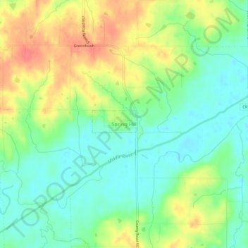
Name: Spring Hill topographic map, elevation, terrain.

Location: Spring Hill, Warren County, Iowa, United States (41.39176 -93.66799 41.43176 -93.62799)

Average elevation: 265 m

Minimum elevation: 241 m

Maximum elevation: 299 m

Gear up for your next adventure:

📍Handheld GPS Navigators - Reliable satellite navigation for hiking and off-road exploration
🧥Breathable Waterproof Jackets - Essential rain protection for the unpredictable British climate
🔋Solar Chargers - Eco-friendly charging solutions for outdoor use
🛰️Outdoor GPS Navigation - Navigation devices for remote and off-grid areas
🧢Waterproof Hiking Hats - Keep the rain off your face while studying topographic maps

As an Amazon Associate, this site earns from qualifying purchases at no extra cost to you.