
Cantalojas topographic map
Interactive map
Click on the map to display elevation.
About this map
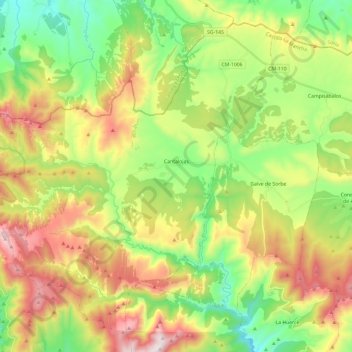
Name: Cantalojas topographic map, elevation, terrain.
Location: Cantalojas, Guadalajara, Castilië-La Mancha, 19274, Spanje (41.14923 -3.41564 41.30443 -3.17860)
Average elevation: 1,425 m
Minimum elevation: 1,081 m
Maximum elevation: 1,929 m