Geolocate

Gabás topographic map

Click on the map to display elevation.

About this map

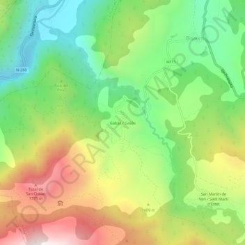
Name: Gabás topographic map, elevation, terrain.

Location: Gabás, Bisaurri, Ribagorza, Huesca, Aragon, 22470, Spain (42.46274 0.47055 42.50274 0.51055)

Average elevation: 1,291 m

Minimum elevation: 844 m

Maximum elevation: 1,921 m

Gear up for your next adventure:

🧊Insulated Flasks - Keeps drinks hot or cold during hikes
🧷Tenacious Repair Tape - Instant fix for torn tents, jackets, or dry bags
🎒Hiking Daypacks (20L) - Compact backpacks for day trips and technical mountain ascents
📕Outdoor Navigation Books - Learn traditional and modern navigation techniques
🧭Professional Hiking Compasses - High-precision liquid-filled compasses for map reading and orientation

As an Amazon Associate, this site earns from qualifying purchases at no extra cost to you.