
Almáchar topographic map
Interactive map
Click on the map to display elevation.
About this map
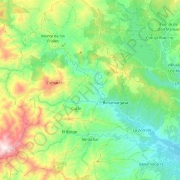
Name: Almáchar topographic map, elevation, terrain.
Location: Almáchar, La Axarquía, Malaga, Andalousie, Espagne (36.78010 -4.25689 36.90845 -4.18236)
Average elevation: 330 m
Minimum elevation: 32 m
Maximum elevation: 1,008 m