
Mansourah topographic map
Interactive map
Click on the map to display elevation.
About this map
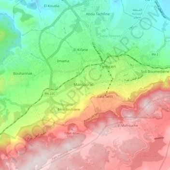
Name: Mansourah topographic map, elevation, terrain.
Location: Mansourah, Tlemcen, Tlemcen District, Tilimsen, 13000, Algeria (34.83300 -1.36965 34.91300 -1.28965)
Average elevation: 879 m
Minimum elevation: 570 m
Maximum elevation: 1,244 m