
Sendjas topographic map
Interactive map
Click on the map to display elevation.
About this map
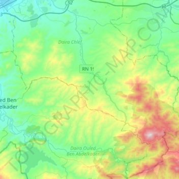
Name: Sendjas topographic map, elevation, terrain.
Location: Sendjas, Chlef District, Chlef, 02025, Algeria (35.93536 1.28951 36.14417 1.53286)
Average elevation: 388 m
Minimum elevation: 96 m
Maximum elevation: 1,176 m