Geolocate

Esteban topographic map

Click on the map to display elevation.

About this map

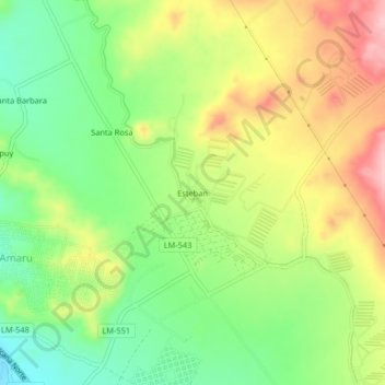
Name: Esteban topographic map, elevation, terrain.

Location: Esteban, Végueta, Province of Huaura, Lima, Peru (-11.02001 -77.60146 -10.98001 -77.56146)

Average elevation: 149 m

Minimum elevation: 75 m

Maximum elevation: 239 m

Gear up for your next adventure:

🕶️Glacier Goggles - Maximum protection for high-altitude snow topography
🥾Hiking Boots - Waterproof and durable boots for long-distance hiking in the UK
🔥Reusable Hand Warmers - Maintain dexterity in your fingers for precise map handling
🧥Waterproof Hiking Jackets - Rain protection for walking in all weather conditions
👖Packable Overtrousers - Quick-deploy rain protection for legs in sudden storms

As an Amazon Associate, this site earns from qualifying purchases at no extra cost to you.