
Thank you for supporting this site ❤️
Make a donation
Make a donation
Gear up for your next adventure:
As an Amazon Associate, this site earns from qualifying purchases at no extra cost to you.
Hijuelas topographic map
Click on the map to display elevation.
Thank you for supporting this site ❤️
Make a donation
Make a donation
Gear up for your next adventure:
As an Amazon Associate, this site earns from qualifying purchases at no extra cost to you.
About this map
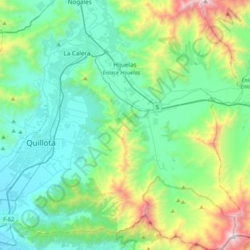
Name: Hijuelas topographic map, elevation, terrain.
Location: Hijuelas, Provincia de Quillota, Valparaiso Region, Chile (-32.99024 -71.17995 -32.73508 -71.00139)
Average elevation: 548 m
Minimum elevation: 74 m
Maximum elevation: 2,213 m
Thank you for supporting this site ❤️
Make a donation
Make a donation
Gear up for your next adventure:
As an Amazon Associate, this site earns from qualifying purchases at no extra cost to you.