
Ruth Lake topographic map
Click on the map to display elevation.
About this map
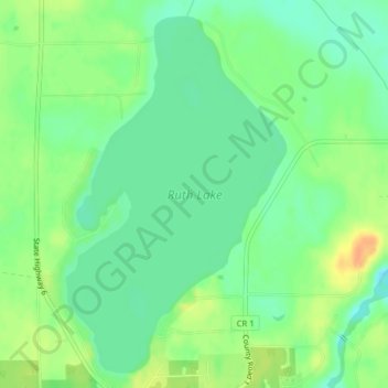
Name: Ruth Lake topographic map, elevation, terrain.
Location: Ruth Lake, Emily, Crow Wing County, Minnesota, United States (46.73682 -93.96405 46.76168 -93.94159)
Average elevation: 391 m
Minimum elevation: 376 m
Maximum elevation: 412 m