Geolocate

Alban topographic map

Click on the map to display elevation.

About this map

Name: Alban topographic map, elevation, terrain.

Location: Alban, French River, Sudbury District, Northeastern Ontario, Ontario, Canada (46.08472 -80.64630 46.12472 -80.60630)

Average elevation: 206 m

Minimum elevation: 176 m

Maximum elevation: 233 m

Other topographic maps

Click on a map to view its topography, its elevation and its terrain.
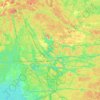
French River

Canada > Ontario > Sudbury District > French River

Average elevation: 205 m

Daoust Lake

Canada > Ontario > Sudbury District > French River

Average elevation: 205 m

Daoust Lake

Canada > Ontario > Sudbury District > French River

Average elevation: 205 m

Gear up for your next adventure:

👖Hiking Trousers - Durable trousers designed for rough terrain
🔭Compact Hiking Binoculars - Lightweight optics for scouting terrain and spotting wildlife
🧊Personal Water Filters - Drink safely from mountain streams marked on your map
🦶Anti-Blister Balms - Protect your feet before long topographic expeditions
🧺Microfibre Travel Towels - Fast-drying and compact towels for wild swimming and camping

As an Amazon Associate, this site earns from qualifying purchases at no extra cost to you.