
Dinkelland topographic map
Interactive map
Click on the map to display elevation.
About this map
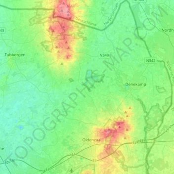
Name: Dinkelland topographic map, elevation, terrain.
Location: Dinkelland, Overijssel, Nederland (52.27296 6.75904 52.46977 7.07220)
Average elevation: 29 m
Minimum elevation: 7 m
Maximum elevation: 88 m
Other topographic maps
Click on a map to view its topography, its elevation and its terrain.
Weerselo
Nederland > Overijssel > Dinkelland
Weerselo, Dinkelland, Overijssel, Nederland
Average elevation: 24 m
Deurningen
Nederland > Overijssel > Dinkelland
Deurningen, Dinkelland, Overijssel, Nederland
Average elevation: 22 m