Geolocate

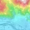
Mocchie topographic map

Click on the map to display elevation.

About this map

Name: Mocchie topographic map, elevation, terrain.

Location: Mocchie, Condove, Torino, Piemonte, 10055, Italia (45.11655 7.27140 45.15655 7.31140)

Average elevation: 956 m

Minimum elevation: 377 m

Maximum elevation: 1,616 m

Other topographic maps

Click on a map to view its topography, its elevation and its terrain.
Vasca Anti Incendio

Italia > Piemonte > Torino > Condove > Giagli

Average elevation: 582 m

Gear up for your next adventure:

🥾Women's Waterproof Hiking Boots - High-performance trekking boots designed for all-weather comfort
🔥Emergency Fire Starters - Reliable ignition tools for survival situations in damp conditions
🥫Expedition Meals - Lightweight, high-calorie nutrition for long-distance hikers
🔋Solar Chargers - Eco-friendly charging solutions for outdoor use
👖Hiking Trousers - Durable trousers designed for rough terrain

As an Amazon Associate, this site earns from qualifying purchases at no extra cost to you.