
Genouilly topographic map
Interactive map
Click on the map to display elevation.
About this map
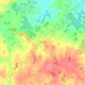
Name: Genouilly topographic map, elevation, terrain.
Average elevation: 136 m
Minimum elevation: 95 m
Maximum elevation: 177 m
Other topographic maps
Click on a map to view its topography, its elevation and its terrain.
Saint-Amand-Montrond
Francia > Centro > Cher > Saint-Amand-Montrond
Saint-Amand-Montrond, Cher, Centro, Francia metropolitana, 18200, Francia
Average elevation: 196 m