
Gasenried topographic map
Interactive map
Click on the map to display elevation.
About this map
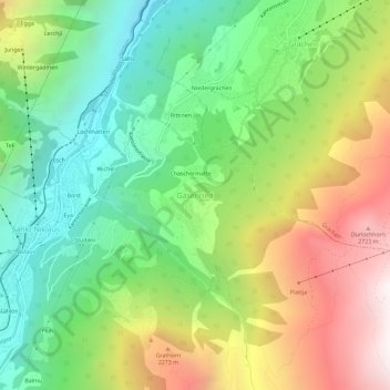
Name: Gasenried topographic map, elevation, terrain.
Location: Gasenried, St. Niklaus, Visp, Wallis, 3924, Schweiz (46.16047 7.80611 46.20047 7.84611)
Average elevation: 1,748 m
Minimum elevation: 967 m
Maximum elevation: 2,926 m
Other topographic maps
Click on a map to view its topography, its elevation and its terrain.
Inners Barrhorn
Schweiz > Wallis > Visp > St. Niklaus
Inners Barrhorn, St. Niklaus, Visp, Wallis, 3924, Schweiz
Average elevation: 3,097 m