
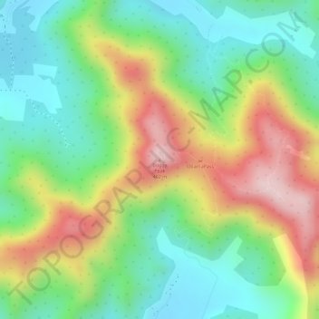
Boggy Peak topographic map
Interactive map
Click on the map to display elevation.
About this map
Name: Boggy Peak topographic map, elevation, terrain.
Location: Boggy Peak, Bolans, Saint Mary, Antigua, Antigua and Barbuda (17.04438 -61.86139 17.04448 -61.86129)
Average elevation: 166 m
Minimum elevation: 20 m
Maximum elevation: 372 m