
Bronston topographic map
Interactive map
Click on the map to display elevation.
About this map
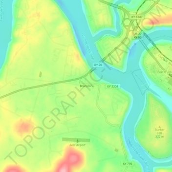
Name: Bronston topographic map, elevation, terrain.
Location: Bronston, Pulaski County, Kentucky, 42518, United States (36.96563 -84.64300 37.00563 -84.60300)
Average elevation: 248 m
Minimum elevation: 195 m
Maximum elevation: 327 m
Other topographic maps
Click on a map to view its topography, its elevation and its terrain.
Drum
United States > Kentucky > Pulaski County
Drum, Pulaski County, Kentucky, United States
Average elevation: 332 m
Somerset
United States > Kentucky > Pulaski County
Somerset, Pulaski County, Kentucky, 42503, United States
Average elevation: 295 m