
Welwood topographic map
Interactive map
Click on the map to display elevation.
About this map
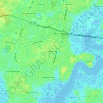
Name: Welwood topographic map, elevation, terrain.
Average elevation: 7 m
Minimum elevation: -5 m
Maximum elevation: 17 m
Other topographic maps
Click on a map to view its topography, its elevation and its terrain.
Oakdale
United States > Georgia > Chatham County > Savannah
Oakdale, Savannah, Chatham County, Georgia, 31406, United States
Average elevation: 10 m