
Anatye topographic map
Interactive map
Click on the map to display elevation.
About this map
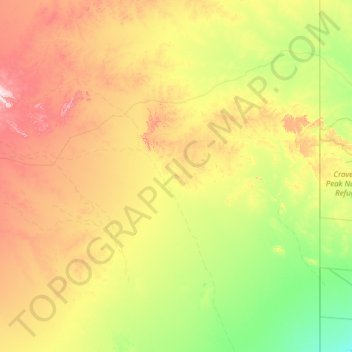
Name: Anatye topographic map, elevation, terrain.
Average elevation: 238 m
Minimum elevation: 97 m
Maximum elevation: 622 m
Other topographic maps
Click on a map to view its topography, its elevation and its terrain.
Yuendumu
Australia > Central Desert Region
Yuendumu, Central Desert Region, Northern Territory, Australia
Average elevation: 678 m
Yuendumu
Australia > Central Desert Region > Yuendumu
Yuendumu, Central Desert Region, Northern Territory, Australia
Average elevation: 674 m