
Güttersbach topographic map
Interactive map
Click on the map to display elevation.
About this map
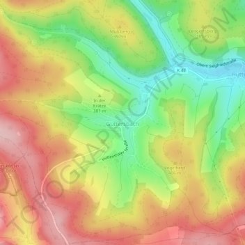
Name: Güttersbach topographic map, elevation, terrain.
Location: Güttersbach, Mossautal, Odenwaldkreis, Hessen, Deutschland (49.59947 8.87563 49.63064 8.92307)
Average elevation: 384 m
Minimum elevation: 280 m
Maximum elevation: 478 m