Geolocate

Loch Long topographic map

Click on the map to display elevation.

About this map

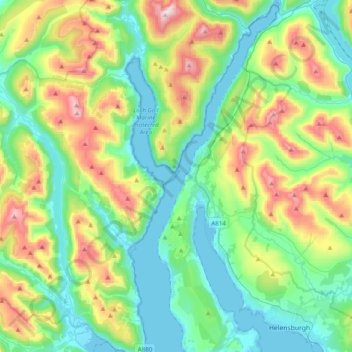
Name: Loch Long topographic map, elevation, terrain.

Location: Loch Long, Ardentinny, Argyll and Bute, Scotland, United Kingdom (55.98783 -4.91451 56.20680 -4.74402)

Average elevation: 238 m

Minimum elevation: -1 m

Maximum elevation: 840 m

Argyll and Bute trails, hiking, mountain biking, running and outdoor activities

Gear up for your next adventure:

🛌Insulated Sleeping Mats - Crucial thermal protection when sleeping on cold, uneven ground
🧦Hiking Socks - Breathable socks designed to prevent blisters on long walks
🔋Power Banks - Portable chargers for long outdoor trips
Insulated Travel Mugs - Keep drinks hot while surveying the landscape from a summit
🧼Technical Clothing Wash - Special soap to clean and restore waterproof membranes

As an Amazon Associate, this site earns from qualifying purchases at no extra cost to you.