
Thank you for supporting this site ❤️
Make a donation
Make a donation
Gear up for your next adventure:
As an Amazon Associate, this site earns from qualifying purchases at no extra cost to you.
Grazalema topographic map
Click on the map to display elevation.
Thank you for supporting this site ❤️
Make a donation
Make a donation
Gear up for your next adventure:
As an Amazon Associate, this site earns from qualifying purchases at no extra cost to you.
About this map
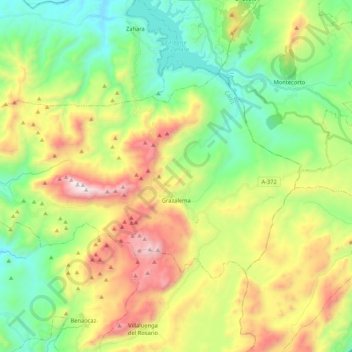
Name: Grazalema topographic map, elevation, terrain.
Location: Grazalema, Sierra de Cádiz, Cádiz, Andalusia, Spain (36.72056 -5.50151 36.81942 -5.29093)
Average elevation: 771 m
Minimum elevation: 281 m
Maximum elevation: 1,622 m
Thank you for supporting this site ❤️
Make a donation
Make a donation
Gear up for your next adventure:
As an Amazon Associate, this site earns from qualifying purchases at no extra cost to you.