
Ak-Baital topographic map
Interactive map
Click on the map to display elevation.
About this map
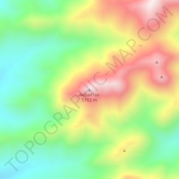
Name: Ak-Baital topographic map, elevation, terrain.
Average elevation: 4,759 m
Minimum elevation: 4,491 m
Maximum elevation: 5,107 m
Other topographic maps
Click on a map to view its topography, its elevation and its terrain.
Vanjyakh Glacier
Tajikistan > Gorno-Badakhshan Autonomous Region > Murghob District
The glacier follows a generally northward path to the east of the 6,595-metre (21,637-foot) Garmo Peak. The glacier begins at an elevation of 6,200 metres (20,300 ft) and eventually melts and empties into the Balandkiik River near the border with Kyrgyzstan at an elevation of 2,909 metres (9,544 ft). Its…
Average elevation: 4,603 m
Pamir Mountains
Tajikistan > Gorno-Badakhshan Autonomous Region > Murghob District
Average elevation: 6,355 m