Geolocate

Hilden topographic map

Click on the map to display elevation.

About this map

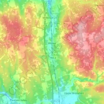
Name: Hilden topographic map, elevation, terrain.

Location: Hilden, Municipality of Colchester, Colchester County, Nova Scotia, Canada (45.26754 -63.37634 45.32815 -63.23147)

Average elevation: 100 m

Minimum elevation: 24 m

Maximum elevation: 185 m

Other topographic maps

Click on a map to view its topography, its elevation and its terrain.

Gear up for your next adventure:

🛑Emergency Bivvy Bags - Heat-reflective survival bags for unexpected nights out
🔦LED Camping Lanterns - Illumination for reading maps inside your tent at night
🧥Waterproof Hiking Jackets - Rain protection for walking in all weather conditions
🕶️Glacier Goggles - Maximum protection for high-altitude snow topography
👟Heavy Duty Boot Laces - Always carry a spare for your hiking footwear

As an Amazon Associate, this site earns from qualifying purchases at no extra cost to you.